
The geology of West Virginia was examined by numerous individuals in the mid and late 1700s and early 1800s with the first comprehensive examination by William Barton Roger, State Geologist of Virginia, from 1835 to 1841. When the West Virginia Geological and Economic Survey was established in 1897, Israel Charles White initiated a program to geologically map the entire State, county by county, at a scale of one inch to one mile. This program, from 1906 to 1939, provided maps and reports for the State that are still in use. During the late 1800s through the present, many detailed studies have been carried out that better defined the coal areas, subsurface, paleontology, oil and gas fields, depositional environments, and mineral resources. Current investigations, including geological mapping, coal studies, oil and gas assessments, and stratigraphic correlations, are being conducted in more detail with modern technology.
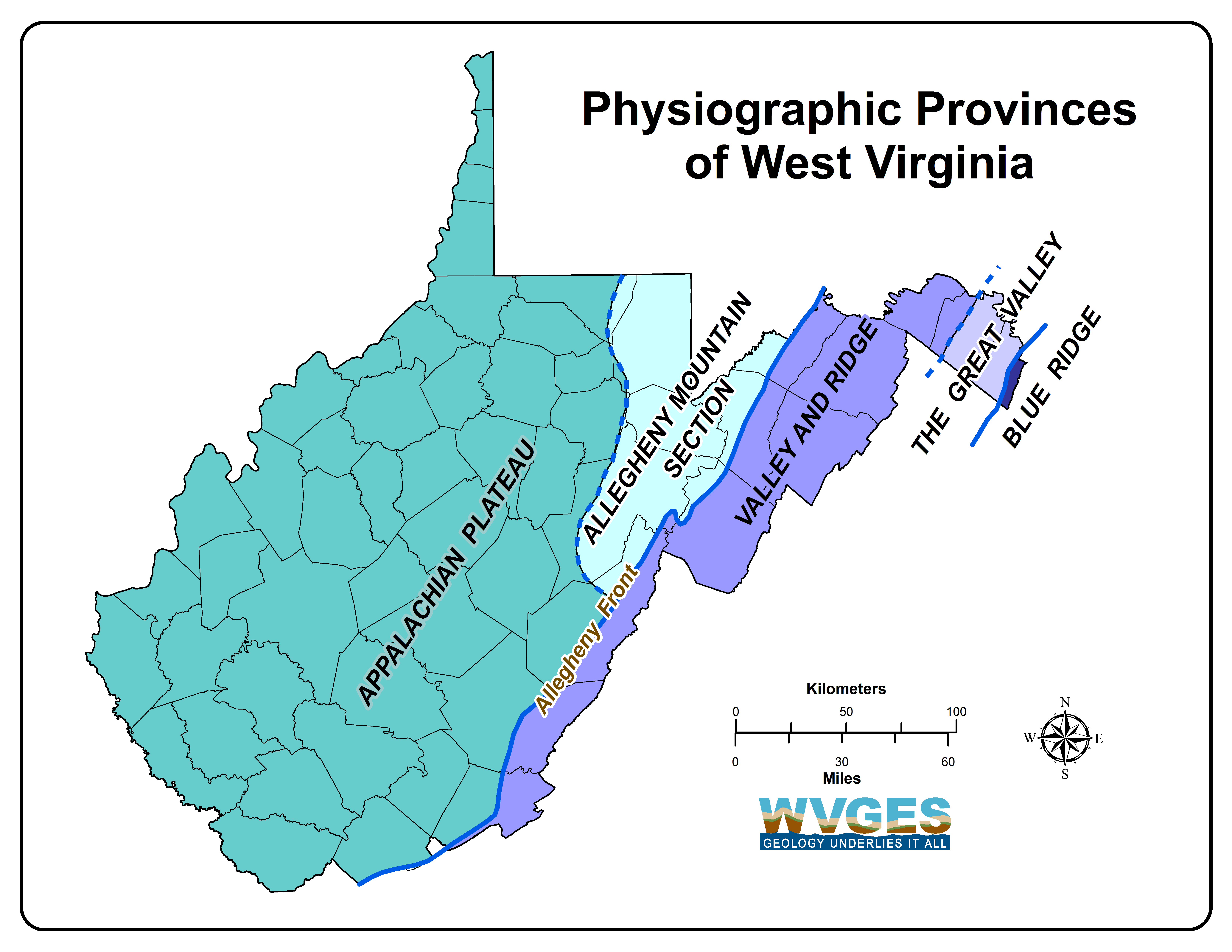
West Virginia mainly has two broad physiographic provinces, the Appalachian Plateau and the Valley and Ridge, along with a very small portion of a third province, the Blue Ridge Physiographic Province. Most of West Virginia is a dissected, westward-tilting plateau called the Appalachian Plateau Province. In the northeast part of this province, a subprovince called the Allegheny Mountain Section combines elements of the folded mountains to the east and the dissected plateau. This western two-thirds of the state are relatively flat-lying rocks containing minable coal. The eastern third of the state is comprised of folded and faulted rocks with no minable coal. The eastern boundary of the Appalachian Plateau, the Allegheny Front, is a prominent geological feature which runs northeast-southwest across the state. East of the Allegheny Front are a series of long folded mountains and valleys defining the Valley and Ridge Province. East of the main group of folded mountains and valleys is the Great Valley subprovince. Along the eastern State boundary in Jefferson County is the Blue Ridge Province. The oldest rocks in the state are located in the extreme eastern part, and as one proceeds westward, the rocks are younger and younger (see general geologic map). More specifically, the oldest rocks in the east are very late Precambrian (the Catoctin Formation) and then a nearly complete section of the Paleozoic is exposed moving to the west (see stratigraphic column). There are no significant Mesozoic or Cenozoic rocks in the State, but overlying most formations is Quaternary alluvium.

Valley and Ridge Province
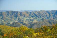
The Valley and Ridge Province in the east contains folded and faulted rocks that range in age from late Precambrian to early Mississippian. The late Precambrian Catoctin Formation is technically in the Blue Ridge Province, but we only have limited outcrops exposed on the Blue Ridge Mountains. From the Blue Ridge Mountains westward for about 20 miles is the Great Valley. This relatively flat, agriculturally rich region is composed of complexly folded and faulted Cambrian and Ordovician limestone and dolomite with one prominent Ordovician shale (the Martinsburg Shale). The Great Valley ends at North Mountain and from here to the Allegheny Front, a distance of about 50 miles, are a series of northeast-trending mountains and valleys. The rocks in this part of the Valley and Ridge range in age from late Ordovician to early Mississippian. The valleys are primarily composed of less-resistant shale and siltstone, while the mountain ridges are mainly resistant sandstone and limestone. The structural geology of the Valley and Ridge is complex with extensive thrust faults and folds that contribute to the repetition of all the rock formations. In addition, three major allochthonous thrust sheets have displaced the surface and subsurface rocks westward in the order of 30 to 50 miles. The interested reader may wish to examine recent geological maps and reports noted in the Survey's publications list.

Appalachian Plateau Province
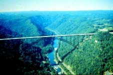
The Appalachian Plateau Province covers the western two-thirds of the State where the rock formations are relatively flat, except for several distinct folds and faults on the eastern side of the Province. The oldest rocks are located in these eastern fold sequences and range in age from late Ordovician up through the Mississippian. The majority of the Appalachian Plateau is comprised of Pennsylvanian and Permian strata and is where all the minable coal is located. The rocks exposed in the northern part of the Plateau are younger than those exposed in the southern part. This is also reflected in the age of the minable coal seams; younger to the north and older in the south. Although some natural gas has been obtained from the Valley and Ridge Province, by far the majority of natural gas (perhaps 95 to 98 percent) and all the oil comes from the Plateau (see also the sections on coal and oil and gas on this web site). The boundary between the two provinces, the Allegheny Front, is a complex and rather abrupt change in the topography, stratigraphy, and structure. This boundary extends southwestward across the eastern part of the State, passes through Virginia, and reenters the State in the southeast in Monroe County.
(modified from Peter Lessing, July 1996)
Most of the rocks in West Virginia are sedimentary, deposited during the Paleozoic Era (600 to 230 million years ago); very few igneous or metamorphic rocks occur in the State. The geologic history of West Virginia prior to one billion years ago is poorly understood. The oldest exposed rock in the State is the Catoctin Greenstone, a metamorphosed lava deposited 800 million years ago. Later, a marine sea covered most of West Virginia and deposited marine limestones, shales, siltstones, and sandstones during the Cambrian and Ordovician periods.
Movements of the earth's tectonic plates cause episodes of mountain building which, with subsequent erosion and production of sediments, can have major effects of the geologic history of an area. The first of these mountain-building episodes to affect West Virginia, the Taconic Orogeny, formed mountains to the east of the State that were a source of sediments during the Ordovician, Silurian, and early Devonian periods. Clastics and carbonates were deposited with clastics predominating in the eastern part of the State. Also, non-marine deposition took place and evaporites were deposited in the northern part of West Virginia in the late Silurian.
Highlands to the northeast, formed in the Acadian Orogeny, were the source of clastic sediments in the Middle and Late Devonian. The sea regressed to the west at the end of the Devonian, and continental red beds were deposited over most of the State. The sea covered West Virginia again in the Middle Mississippian (about 330 million years ago). During this time, the Greenbrier Group, composed mainly of limestone, was deposited.
The sea retreated again near the end of the Mississippian, and during the Pennsylvanian, West Virginia was low-lying and swampy. During this period, thousands of feet of non-marine sandstone, shale, and coal were deposited.
During the Permian Period, the Appalachian Orogeny began, which was the dominant geologic event in the formation of the Appalachian Mountains. Much folding and thrust-faulting occurred, especially in the eastern part of the State. Erosion became the predominant geological processes.
No sedimentary rocks from the Mesozoic Era (230 to 70 million years ago) exist in West Virginia. However, hundreds of igneous dikes from this time are found in Pendleton County.
The glaciers of the ice ages never reached West Virginia. A large lake caused by an ice dam to the north resulted in lake deposits in the northern part of the State and drainage changes and alluvial deposits in the southern part. These are the only Cenozoic Era (younger than 70 million years ago) deposits in West Virginia.
 WV Geological & Economic Survey