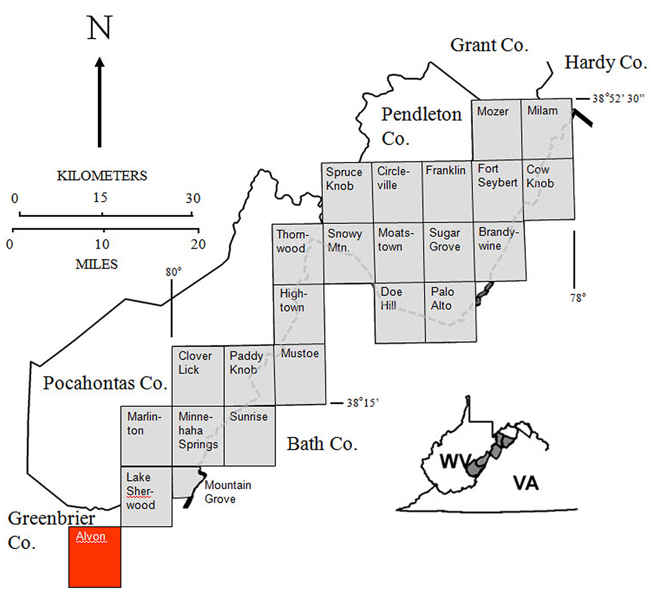
STATEMAP Project for 2015:
Alvon, West Virginia

Bedrock Geology of the Alvon Quadrangle, Open-File Publication OF-1503
Principal Investigators: Paula Hunt and Ronald McDowell (WVGES)
Geological Assistants: Goldie McClure and Mary Sue Burns (Pocahontas County High School, Dunmore, WV)

Bedrock Geology of the Alvon Quadrangle
The West Virginia Geological and Economic Survey (WVGES) mapped the bedrock and collected rock samples for geochemical analysis on the Alvon, West Virginia quadrangle (see location map) from June 2015 through May 2016. WVGES geologists Paula Hunt and Ronald McDowell were assisted by Goldie McClure and Mary Sue Burns (Pocahontas County High School, Dunmore, WV) during the field season. Ms. McClure's participation was part of a mentorship through Pocahontas County High School. Funding for Ms. Burns' salary and field expenses was provided by the West Virginia Geological and Economic Survey and the United States Geological Survey (USGS).
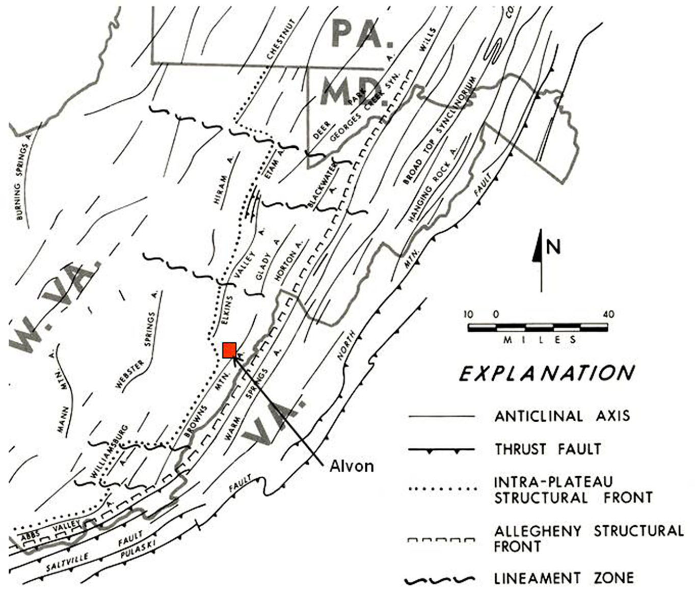
This bedrock mapping is a continuation of mapping from north to south along the strike of the Brown's Mountain Anticlinorium between the Allegheny Front to the east and the Appalachian Plateau to the west (see physiographic province map below). The area exhibits a mixture of moderate to very complex folding and faulting, which is most notable in the west portion of the Alvon Quadrangle. Strikes, fold axes, and fault traces generally trend northeast-southwest. Intense folding in the study area associated with the Brown's Mountain Anticline was probably initiated by thrust faulting deeply ''rooted'' in Silurian or Ordovician shales present in the subsurface. Deformation propagates readily through overlying units resulting in west-vergent compressional folding of strata in the area. Large- and small-scale features and mineralization provide notable and photogenic evidence of this deformation in the map area. The Department of Geology and Geography of West Virginia University operated its undergraduate field camp from Camp Wood for several decades and had a small mapping project at Alvon Gap. WVGES geologists would like to thank WVU Professors Thomas Kammer, Steven Kite, and Jaime Toro for providing their field camp mapping exercises in the Alvon, Marlinton, and White Sulphur Springs areas for examination.

Stratigraphic units encountered in the Alvon area range in age from Silurian through Mississippian. (Click to enlarge.)

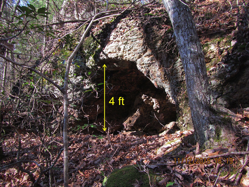
Anthony Cave was formed by tight folding of Silurian rocks. The Cave's roof, the resistant Williamsport Sandstone, overhangs a cavity formed by erosion of the shales of the underlying McKenzie Formation. The Cave's entrance is only about 5 feet high. Location: Anthony Creek, west of Alvon, Greenbrier Co., WV. (Click to enlarge.)
Iron and manganese exploration was active in the map area in the late 1800s, early 1900s (Grimsley, 1908), and early 1940s as part of the World War II war effort (Reeves, 1942). A later manganese study was conducted by Cannon and others (1994). Few of the iron prospects were economically significant, but one iron mine located north of Anthony Creek Gap reportedly operated into the 1960s (Carl Wade, personal communication). Grimsley's 1908 maps show that some of the current state and US Forest Service roads, including North Fork Road in Greenbrier County, were rail corridors in the late 1800s. Old mines and prospects are overgrown and cannot be located with confidence unless ore-containing rock is found nearby.
Shallow adit thought to be part of the Little Creek iron prospect developed in deformed Devonian Oriskany Sandstone. Location: Beaver Lick Mountain, Monongahela National Forest, Greenbrier Co., WV. (Click to enlarge.)
Brecciated Oriskany Sandstone recemented with iron minerals, primarily goethite. Lack of rotation of Oriskany clasts suggests this is not fault gouge. Largest clast visible is approximately 3 inches across. Location: Beaver Lick Mountain, Monongahela National Forest, Greenbrier Co., WV. (Click to enlarge.)
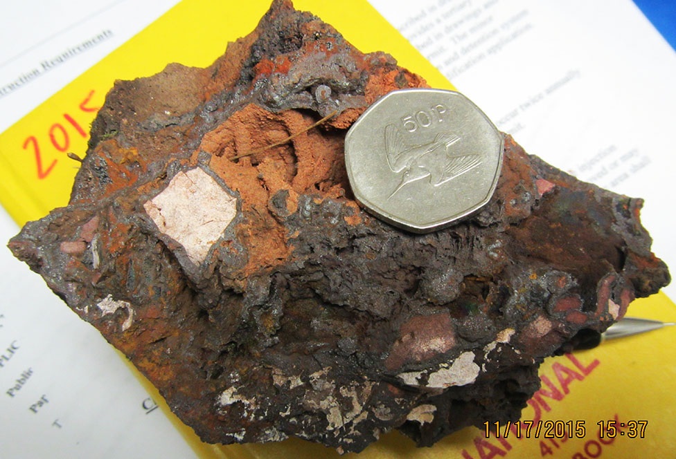
Sample from the Little Creek iron prospect. Goethite ore is concentrated in fractures in deformed Oriskany Sandstone. Inclusion of Oriskany clasts reduces the iron content of this sample to just over 20% iron by weight; other samples from the same area exceed 40% iron by weight. Coin is 3 cm in diameter. Location: Beaver Lick Mountain, Monongahela National Forest, Greenbrier Co., WV. (Click to enlarge.)
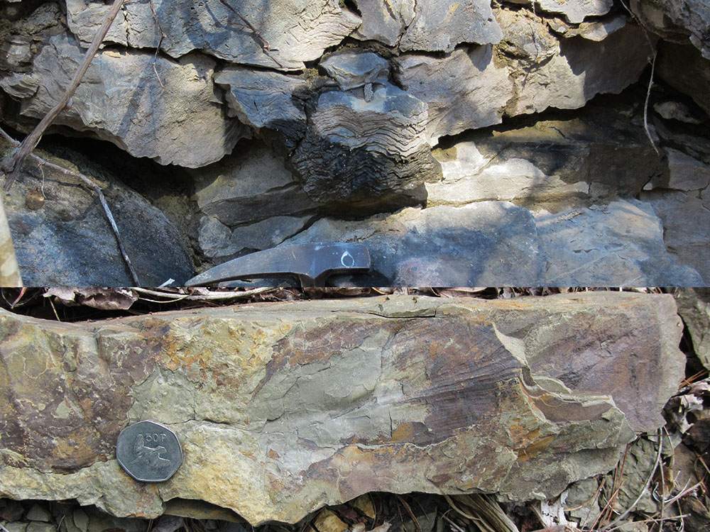
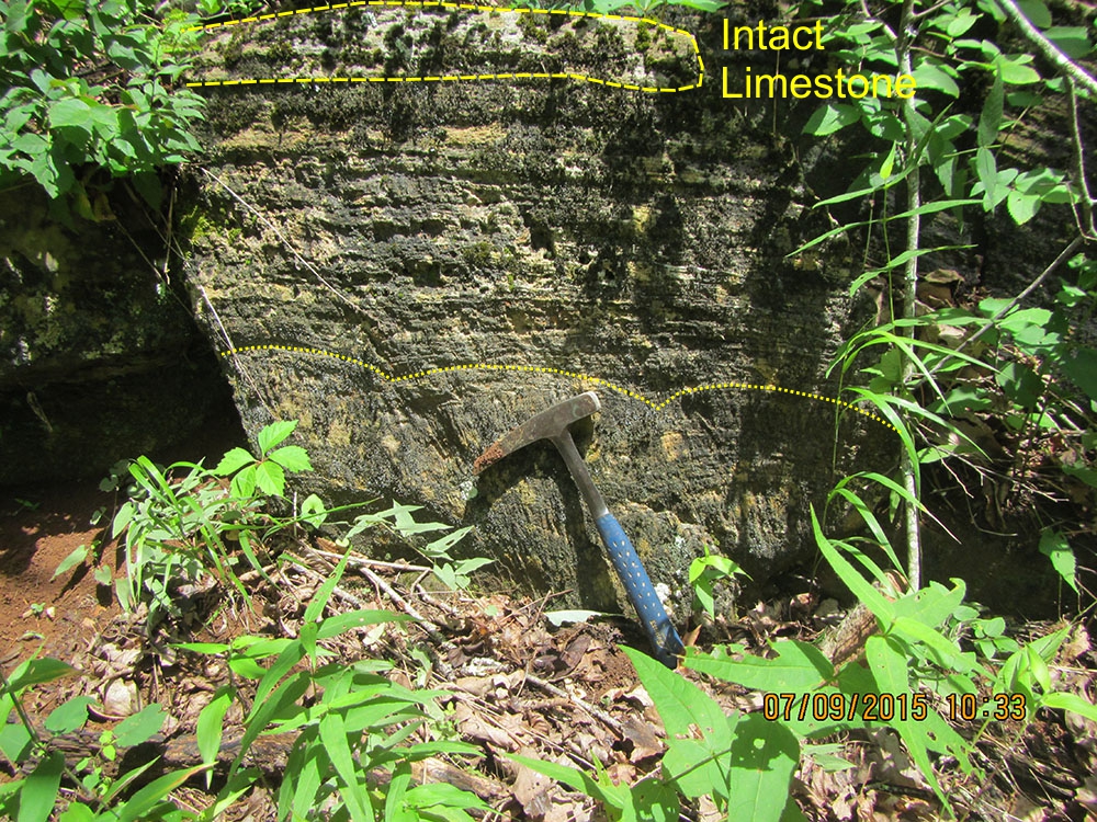 Evidence of paleokarst in the Silurian Wills Creek Formation. Outcrop shows a formerly aragonitic (CaCO3 travertine deposit evidenced by the radial structures at the base. All has been replaced by calcite. A fragment of the original limestone is present at the top of the outcrop; rock hammer for scale. Location: Beaver Lick Mountain, Monongahela National Forest, Greenbrier Co., WV. (Click to enlarge.)
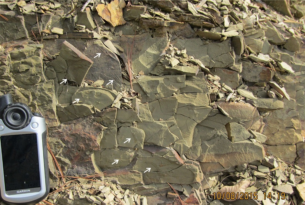
Partial exposure of the "acme" or maximum abundance zone of the trace fossil Pteridichnites biseriatus (arrows) near the base of the Devonian Brallier Formation. Identifying this zone helps place exposures of the abundant shales of the Brallier into stratigraphic context. GPS unit is 5 inches long. Location: WV 92, southwest of Shryock, Greenbrier Co., WV. (Click to enlarge.)
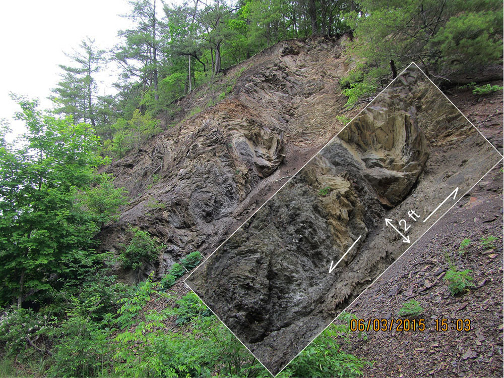
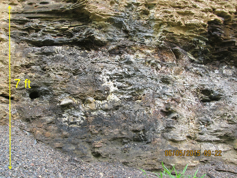
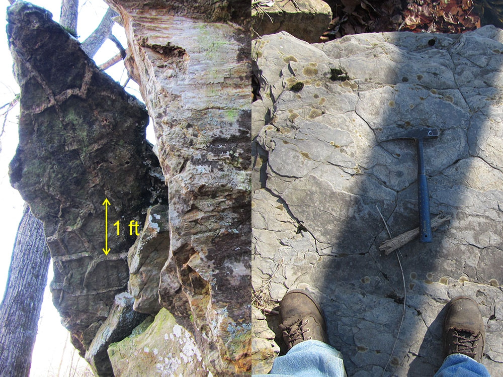
Intense, multistage deformation of the Devonian Millboro Shale. Thick (15 ft) interval of tightly folded Millboro has moved along a 2 ft-thick fault zone (see inset for detail). Location: WV 92, southwest of Shryock, Greenbrier Co., WV. (Click to enlarge.)
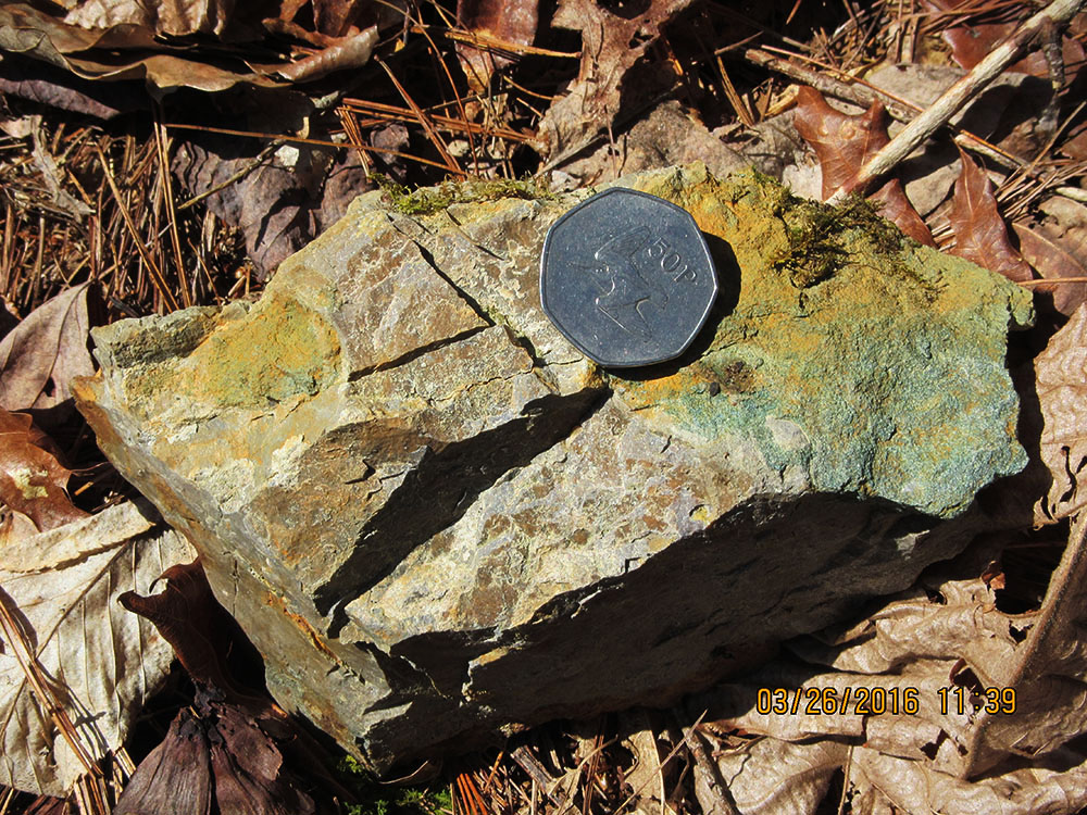
Bedded gray chert of the Devonian Huntersville Chert and green glauconitic ((K,Na)(Fe,Al,Mg)2(Si,Al)4O10(OH)2) sandstone of the Devonian Bobs Ridge Formation in the same rock sample. WVGES geologists refer to this part of the stratigraphic section as the ''Huntersville Interval.'' Coin is 3 cm in diameter. Location: Cole Mountain, Monongahela National Forest, Greenbrier Co., WV. (Click to enlarge.)
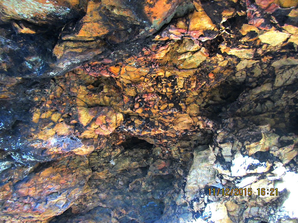
Outcrop of Devonian Millboro Shale covered with an efflorescence or ''bloom'' of iron sulfate mineralization. This pale yellow, powdery substance may be siderotil (FeSO4· 5H2O), a product of weathering and oxidation of pyrite from the Millboro. Location: Anthony Creek, north of Camp Wood, Greenbrier Co., WV. (Click to enlarge.)
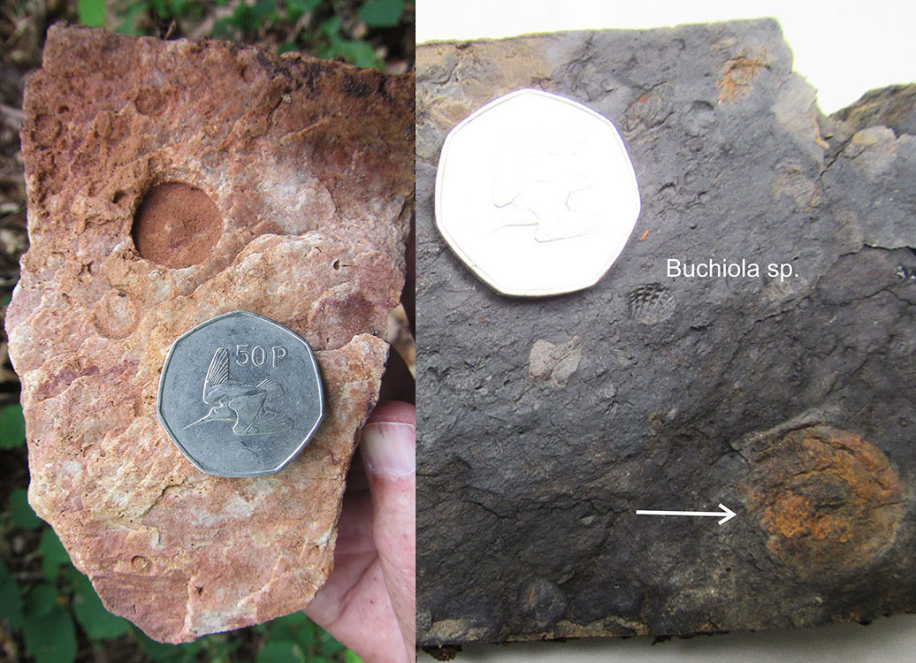
Left, molds of crinoid columnals in the the Devonian Oriskany Sandstone. Right, mold of the exterior of the small clam, Buchiola sp. and a much flattened and unidentified cephalopod (arrow). Coin in both photos is 3 cm in diameter. Location: near Beaver Lick Mountain, Monongahela National Forest, Greenbrier Co., WV. (Click to enlarge.)
In previous years, the Silurian Tonoloway, Wills Creek, and Williamsport formations have been observed as distinct mapping units, and, farther north, along the West Virginia/Virginia border, the Silurian McKenzie and Keefer formations are differentiable. However, heavy vegetation and soil cover along with limited exposure hamper the delineation of all formation contacts except for the most resistant units. For the current mapping project, the Tonoloway, Wills Creek, and Williamsport were mapped as a single unit; the McKenzie and Keefer were also treated as a single unit.
Top, crenulated algal stromalites in the Silurian Tonoloway Limestone. Rock hammer for scale. Bottom, impression of the foliage of an unidentified plant from the Devonian Foreknobs Formation. Coin is 3 cm in diameter. Location: Beaver Lick Mountain, Monongahela National Forest, Greenbrier Co., WV and White's Draft, Monongahela National Forest, Greenbrier Co., WV. (Click to enlarge.)
Left, well-developed mudcracks visible on the bottom of an overhanging ledge of Silurian Williamsport Sandstone. Right, poorly preserved polygonal mudcracks on the top of a bed of Silurian Tonoloway Limestone. Rock hammer for scale. Location: Anthony Creek, south of Camp Wood, Monongahela National Forest, Greenbrier Co., WV. (Click to enlarge.)
GEOCHEMICAL ANALYSES
Geologists collected a total of 28 bedrock samples for geochemical analysis during the field season. These analytical results are included with results from past year's STATEMAP projects in a geochemical database available as West Virginia Geological Survey Report of Investigations RI-34 (McDowell, 2001 with ongoing updates). More than one thousand samples have been collected to date and analyzed for 50 elements (Au, Ag, As, Ba, Br, Ca, Co, Cr, Cs, Fe, Hf, Hg, Ir, Mo, Na, Ni, Rb, Sb, Sc, Se, Sn, Sr, Ta, Th, U, W, Zn, La, Ce, Nd, Sm, Eu, Tb, Yb, Lu, Cu, Pb, Mn, Cd, Bi, V, P, Mg, Ti, Al, K, Y, Be, S, and Li). Summary statistics are included with data. The database spreadsheet and GIS shapefile of the database are available here.
REFERENCES CITED
Cannon, W.F., S.H.B. Clark , F.G. Lesure, M.E. Hinkle, R.L. Paylor, H.M. King, C.M. Simard, K.C., Ashton, and J.S. Kite, 1994, Mineral resources of West Virginia: U.S. Geological Survey Miscellaneous Investigations Series MAP I-2364-A, 14 p., 1 map sheet 1:500,000 scale. More publication information is here.
Grimsley, G., 1909, Iron Ores, Salt, and Sandstones, Volume 4: West Virginia Geological and Economic Survey, 603 p. More publication information is here.
Kulander, B. and Dean, S., 1978, Gravity, Magnetics, and Structure: Allegheny Plateau/Western Valley and Ridge in West Virginia and Adjacent States: West Virginia Geological and Economic Survey Report of Investigations RI-27, 91 p. More publication information is here.
McDowell, R., compiler, 2001 with ongoing updates, Stratigraphic Geochemical Database for Portions of Pendleton, County, West Virginia
and Adjacent Virginia Counties, covering portions of Pendleton Co., WV, Highland Co. VA, and Augusta Co., VA: West
Virginia Geological and Economic Survey, Report of Investigations RI-34, data file. More publication information is here.
Reeves, Frank, 1942, Summary of Recent Prospecting for Manganese and Iron Ores in Southeastern West Virginia: West Virginia Geological and Economic Survey, Bulletin 6, 50 p. More publication information is here.
PHOTOGRAPHIC CREDIT
Ronald McDowell