STATEMAP Project for 2017:
White Sulphur Springs, West Virginia

Bedrock Geology of the White Sulphur Springs Quadrangle, Open-File Publication OF-1705
Principal Investigators: Paula Hunt and Ronald McDowell (WVGES)
Geological Assistant: Mary Sue Burns (Pocahontas County High School, Dunmore, WV)

Bedrock Geology of the White Sulphur Springs Quadrangle
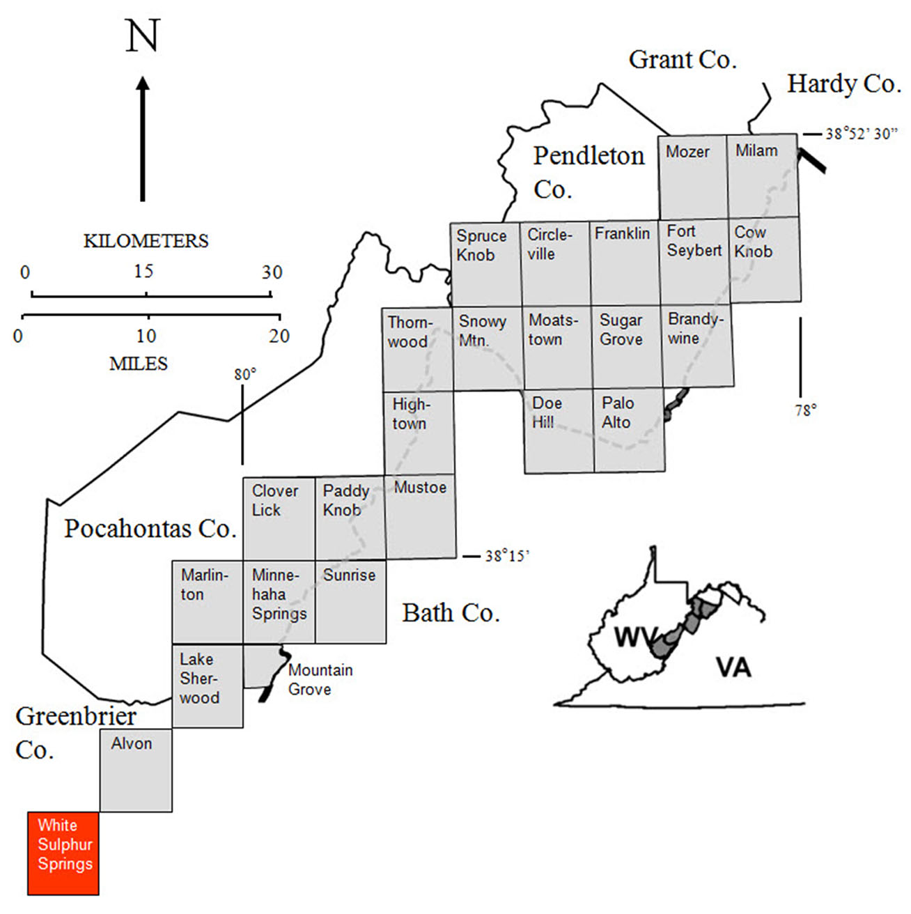
The West Virginia Geological and Economic Survey (WVGES) mapped the bedrock and collected rock samples for geochemical analysis on the White Sulphur Springs, West Virginia quadrangle (see location map) from June 2017 through May 2018. WVGES geologists Paula Hunt and Ronald McDowell were assisted by Mary Sue Burns (Pocahontas County High School, retired, Dunmore, WV) during the field season. Funding for Ms. Burns' salary and field expenses was provided by the West Virginia Geological and Economic Survey and the United States Geological Survey (USGS).
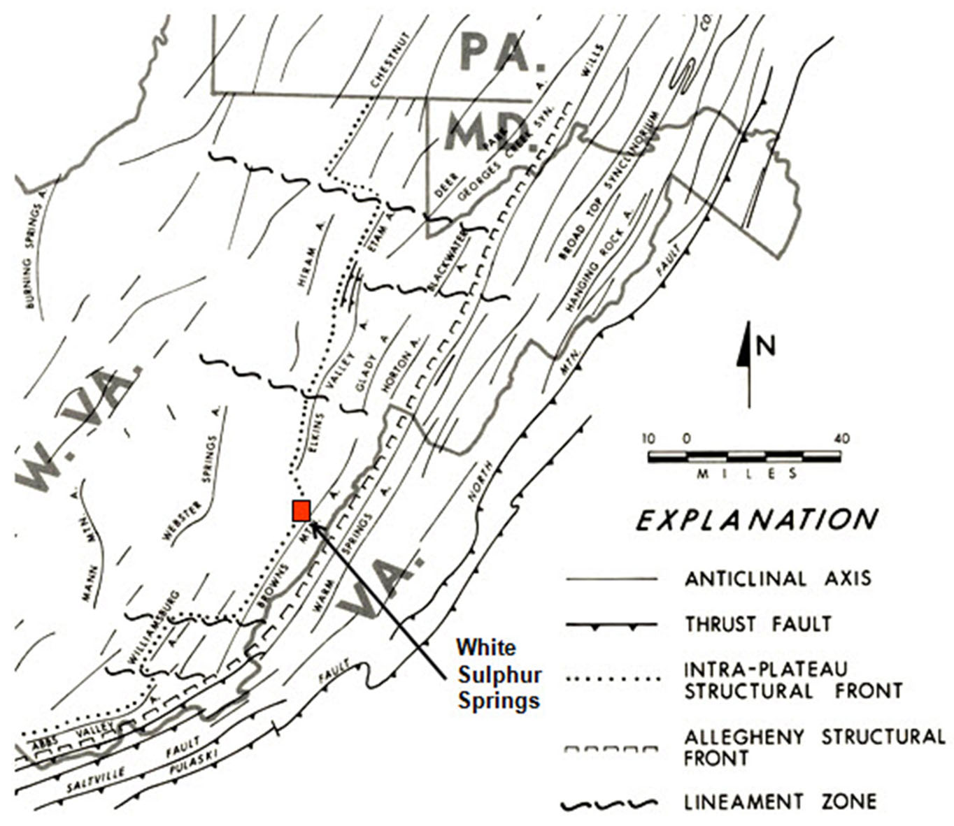
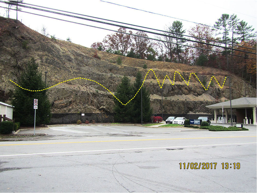
This bedrock mapping is a continuation of mapping from north to south along the strike of the Brown's Mountain Anticlinorium between the Allegheny Front to the east and the Appalachian Plateau to the west (see physiographic province map below). The area exhibits a mixture of moderate to very complex folding and faulting, which is most notable in the southeast portion of White Sulphur Springs Quadrangle. Strikes, fold axes, and fault traces generally trend northeast-southwest. Intense folding in the study area associated with the Brown's Mountain Anticline was probably initiated by thrust faulting deeply ''rooted'' in Silurian or Ordovician shales present in the subsurface. Deformation propagates readily through overlying units resulting in west-vergent compressional folding of strata in the area. Large- and small-scale structural features provide notable and photogenic evidence of this deformation in the map area. For several decades, the Department of Geology and Geography of West Virginia University operated its undergraduate field camp from Camp Wood on the adjacent Alvon Quadrangle. WVGES geologists would like to thank WVU Professors Thomas Kammer, Steven Kite, and Jaime Toro for providing their field camp mapping exercises in the Alvon, Marlinton, and White Sulphur Springs areas for examination.
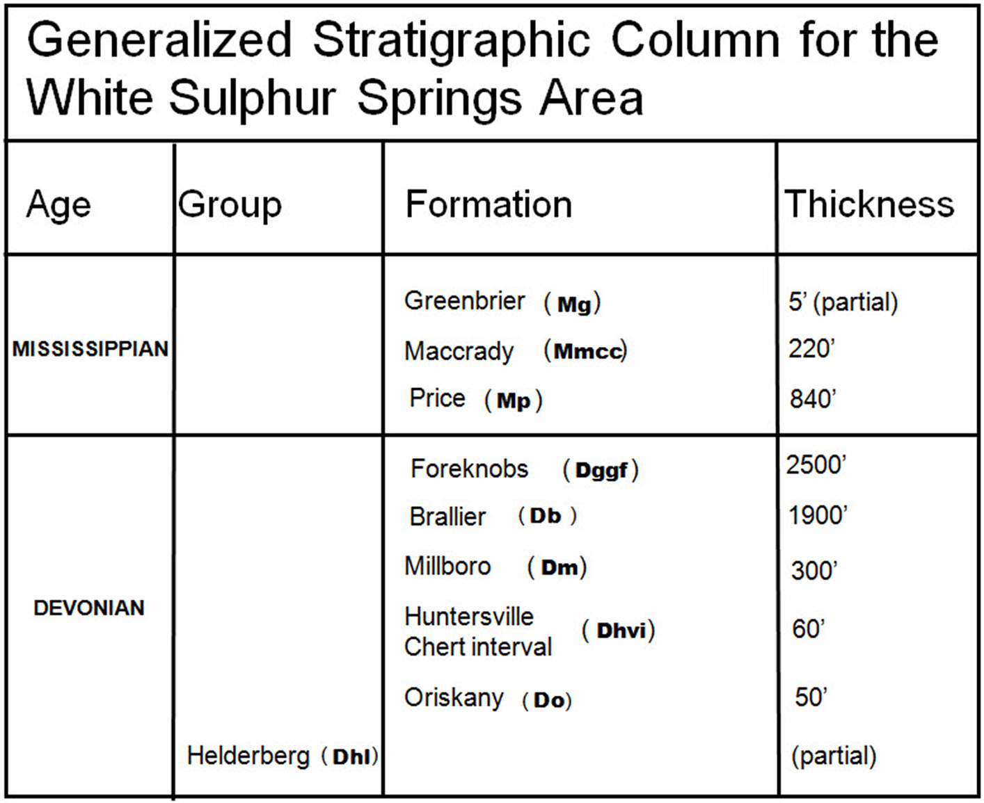
Stratigraphic units encountered in the White Sulphur Springs area range in age from Devonian through Mississippian. (Click to enlarge.)
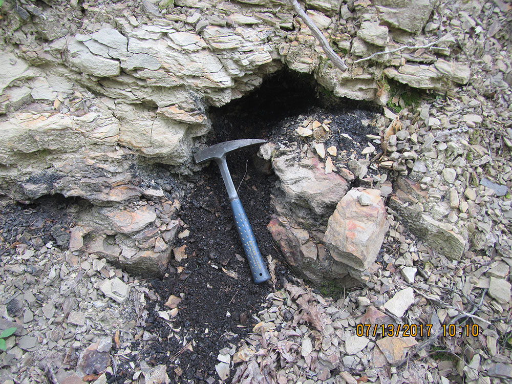
The majority of the coal mined in West Virginia is Pennsylvanian, but thin, discontinuous, non-economic coals from older geologic ages are present. Above is an exposed pod of coal from the Mississippian Price Formation. Rock hammer is 22 inches in length. Location: Southeast of Hopper, Greenbrier Co., WV. (Click to enlarge.)
Notable changes in the characteristics of sedimentary units were observed in the White Sulphur Springs area. We found that the Devonian Brallier and Foreknobs formation seem to be "converging" in lithologic content and components as one travels southward along strike. The Brallier appears to contain more thin sandstone beds and, surprisingly, an increased number of body fossils. The Foreknobs has fewer thick sandstone beds but more thin beds and fewer body fossils. More strikingly, the Devonian Hampshire Formation thins down to merely a thin reddish residuum from hundreds of feet of thickness to the north on the Marlinton Quadrangle. Over the same area, the Mississippian Maccrady Formation thickens to more than 200 feet of thickness from a few tens of feet in the Marlinton area. The various stratigraphic units exposed in the White Sulphur Springs area are illustrated photographically.
The oldest exposed unit in the map area is the Devonian Helderberg Formation. The uppermost Helderberg is typically at least partially silicified. Flint nodules visible on an exposed bedding surface. Rock hammer for scale. Location: Mapledale, Greenbrier Co., WV. (Click to enlarge.)
Silicification in the uppermost Helderberg leads to different rates of erosion for silicified and unsilicified carbonate. Differential weathering caused this unusual expression - silicified beds are clearly more resistant. Rock hammer for scale. Location: Mapledale, Greenbrier Co., WV. (Click to enlarge.)
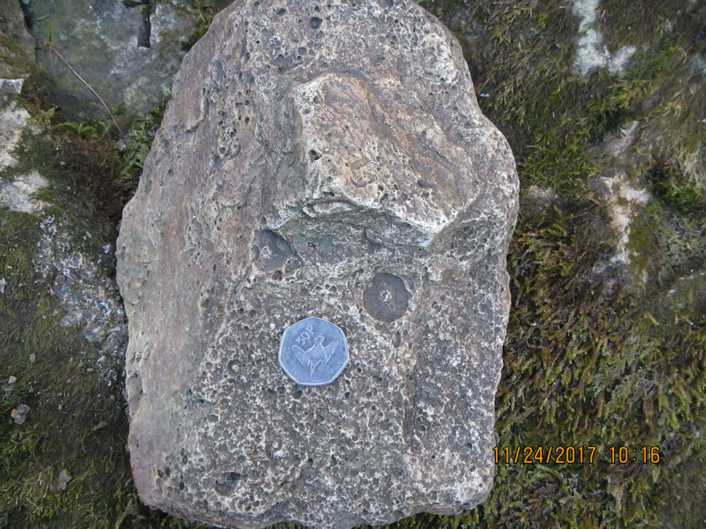
The Devonian Oriskany Sandstone in the map area frequently contains lags consisting of the molds of crinoid columnal disks. Some can be of strikingly large size. None of the original carbonate skeletal material is preserved. Coin is 3 cm in diameter. Location: Mapledale, Greenbrier Co., WV. (Click to enlarge.)
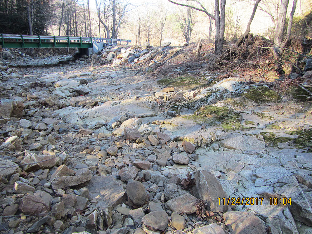
The bed of this dry creek is controlled by exposed bedrock of Devonian Oriskany Sandstone. Very little sediment is present on this resistant surface - occasional, high-energy stream flow flushes all of the fine material out of the system. Location: Southwest of Mapledale, Greenbrier Co., WV. (Click to enlarge.)
Dark grey flint from the Devonian Huntersville in the bed of a small creek. Stratigraphically close to the underlying unit, significant amounts of quartz sand grains in the flint suggest the Huntersville here includes partially silicified Oriskany Sandstone. Location: WV 92, southwest of Wild Meadow, Greenbrier Co., WV. (Click to enlarge.)
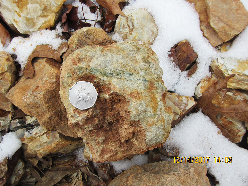
Pale green glauconitic sandstone from the Devonian Bobs Ridge as a piece of float. This is some of the last identifiable material remaining after construction on the top of Bobs Ridge, the type locality for the Sandstone. Coin is 3 cm in diameter. Location: Bobs Ridge, Greenbrier Co., WV. (Click to enlarge.)
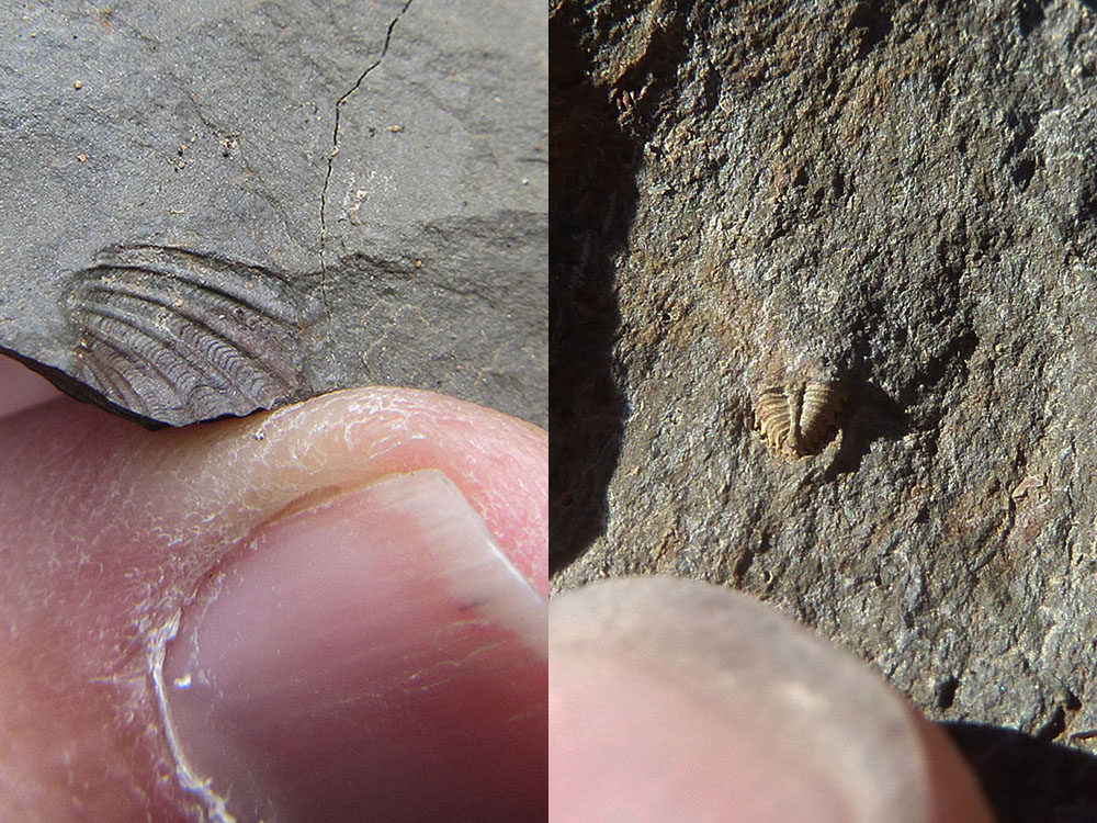
In the map area, the Devonian Millboro Shale is marked by diminutive adult fossils usually indicative of inhospitable conditions such as very high salinity or low oxygen. Left, the clam Buchiola scabrosa?; right, the tail of trilobite Greenops calliteles?. Location: Dutch Hollow, southwest of Mapledale, Greenbrier Co., WV. (Click to enlarge.)
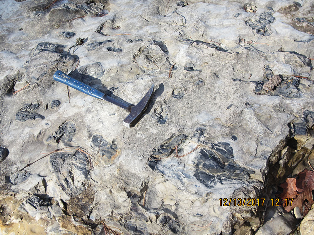
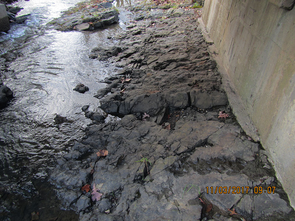
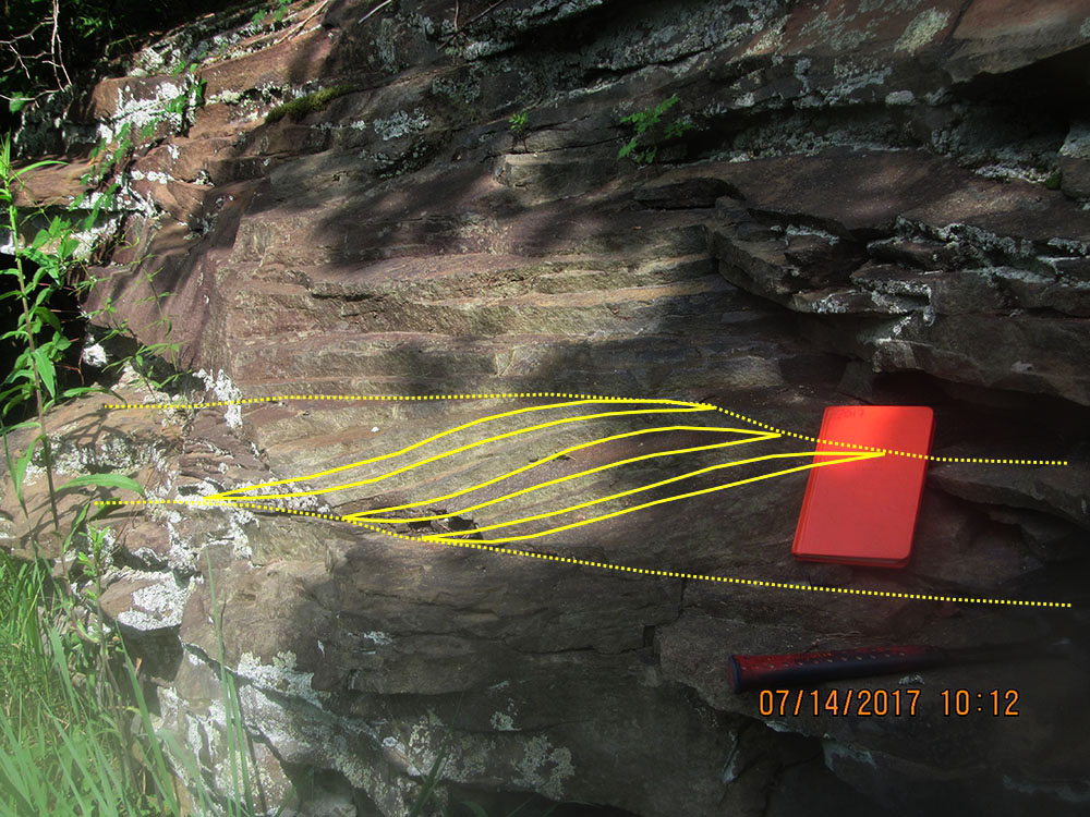
Exposure of Devonian Millboro Shale showing bedding deformed by compression. Angular chevron folds on the right side of the photo give way to gentler, more concordant folds on the left. Location: Junction WV 92/US 60, White Sulphur Springs, Greenbrier Co., WV. (Click to enlarge.)
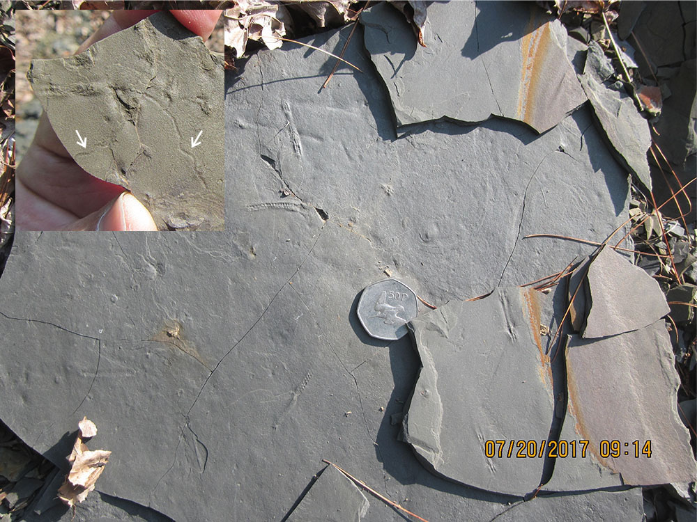
Top of a bed of Devonian Brallier Formation from the Pteridichnites biseriatus Abundance Zone near the base of the unit. Coin is 3 cm in diameter. Inset in the upper left shows examples of another trace fossil (arrows), Cochlichnus sp., from the same unit. Location: Dutch Hollow, southwest of Mapledale, Greenbrier Co., WV. (Click to enlarge.)
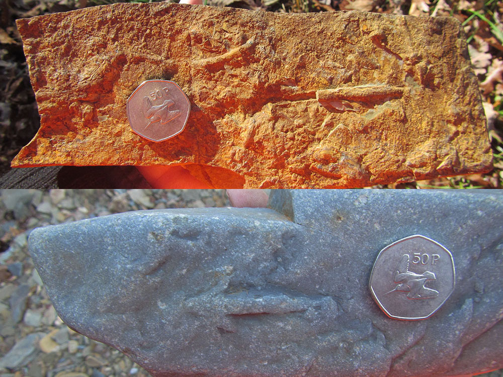
Top, curved and straight, horizontal feeding trace fossils in the Devonian Foreknobs Formation. Bottom, sandstone bed from the Foreknobs with the distinctive trace fossil, Bifungites. sp. Coin in both photos is 3 cm in diameter. Location: Near Harts Run, Greenbrier State Forest, Greenbrier Co., WV. (Click to enlarge.)
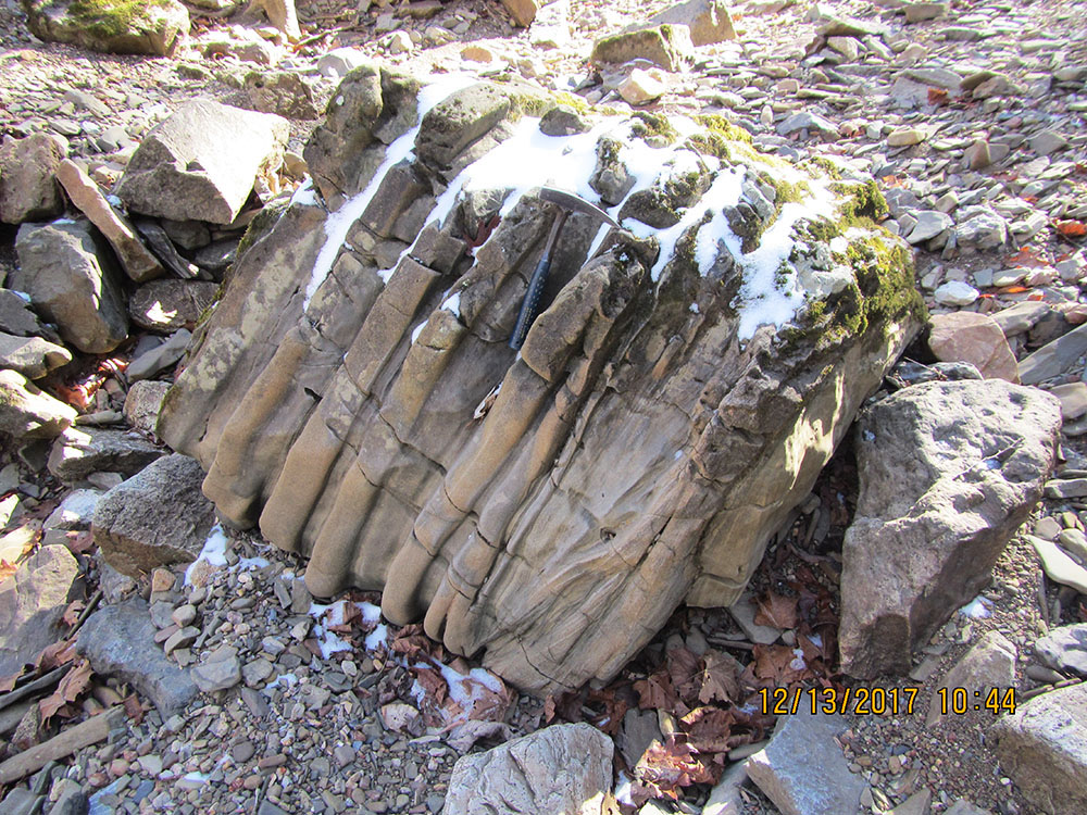
Small, lenticular channel filled with "epsilon"-crossbedded, fine-grained sandstone in the Mississippian Price Formation. Channel filled from right to left. Notebook for scale is 19 cm in length. Location: Hopper, Greenbrier River Trail, Greenbrier Co., WV. (Click to enlarge.)
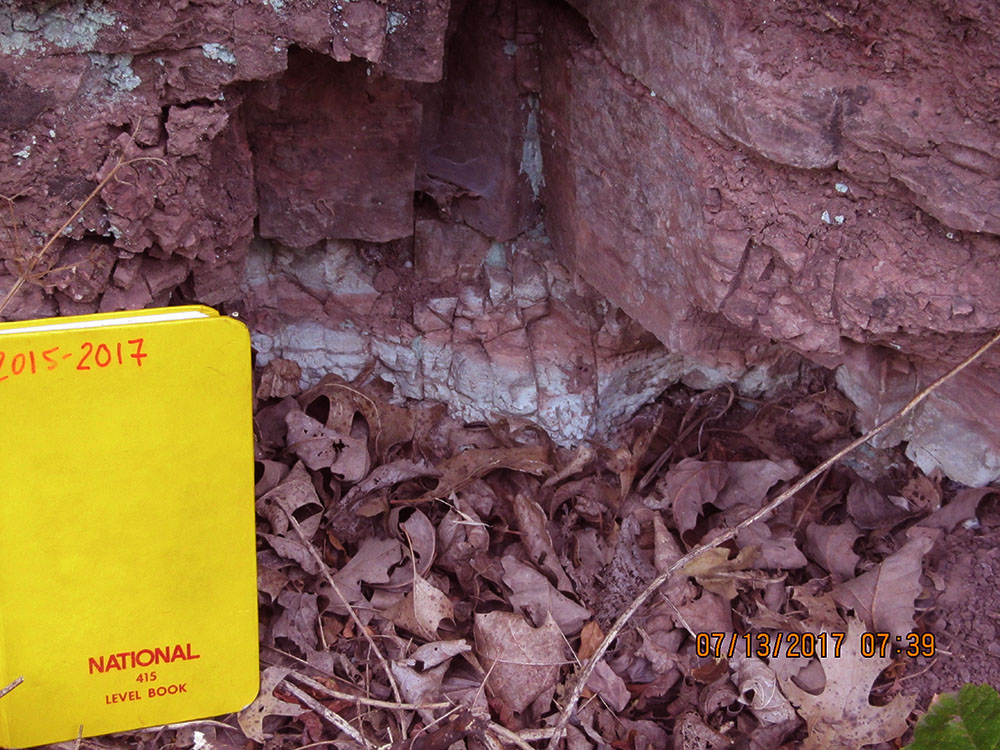
Dark maroon mudstones of the Mississippian Maccrady Formation are occasionally interrupted by pale, greenish-white layers. These may represent old soil zones that formed in an arid climate. Notebook for scale is 19 cm in length. Location: Caldwell, Greenbrier Co., WV. (Click to enlarge.)
GEOCHEMICAL ANALYSES
Geologists collected a total of 15 bedrock samples for geochemical analysis during the field season. These analytical results are included with results from past year's STATEMAP projects in a geochemical database available as West Virginia Geological Survey Report of Investigations RI-34 (McDowell, 2001 with ongoing updates). More than one thousand samples have been collected to date and analyzed for 50 elements (Au, Ag, As, Ba, Br, Ca, Co, Cr, Cs, Fe, Hf, Hg, Ir, Mo, Na, Ni, Rb, Sb, Sc, Se, Sn, Sr, Ta, Th, U, W, Zn, La, Ce, Nd, Sm, Eu, Tb, Yb, Lu, Cu, Pb, Mn, Cd, Bi, V, P, Mg, Ti, Al, K, Y, Be, S, and Li). Summary statistics are included with data. The database spreadsheet and GIS shapefile of the database are available here.
REFERENCES CITED
Hunt, P.J., R.R. McDowell, M.S. Burns, Digital Cartography by S.E. Gooding, 2018, Bedrock Geology of the White Sulphur Springs 7.5' Quadrangle, WV: West Virginia Geological and Economic Survey, Open-File Report OF-1705, 1 map sheet, 1:24,000 scale. More publication information is here.
Kulander, B. and Dean, S., 1978, Gravity, Magnetics, and Structure: Allegheny Plateau/Western Valley and Ridge in West Virginia and Adjacent States: West Virginia Geological and Economic Survey Report of Investigations RI-27, 91 p. More publication information is here.
McDowell, R., compiler, 2001 with ongoing updates, Stratigraphic Geochemical Database for Portions of Pendleton, County, West Virginia
and Adjacent Virginia Counties, covering portions of Pendleton Co., WV, Highland Co. VA, and Augusta Co., VA: West
Virginia Geological and Economic Survey, Report of Investigations RI-34, data file. More publication information is here.
PHOTOGRAPHIC CREDIT
Ronald McDowell, Mary Sue Burns