 STATEMAP Project for 2012:
Minnehaha Springs and Sunrise Quadrangles
STATEMAP Project for 2012:Preliminary Bedrock Geologic Map of the West Virginia Portions of the Minnehaha Springs and Sunrise Quadrangles
Publication OF-1202
Principal Investigators: Ronald McDowell, Paula Hunt, Jaana Hitzig, Phil Dinterman, George Case, Jaen Sidney (WVGES)
Geological Assistant: Mary Sue Burns (Pocahontas County High School, Dunmore, WV)
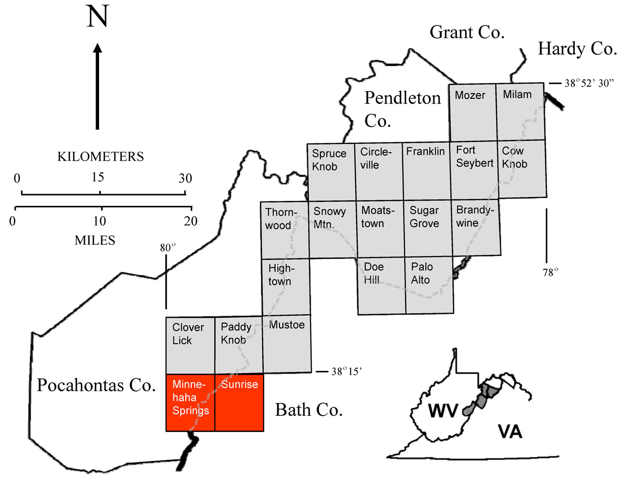
Reconnaissance bedrock mapping and geochemical sampling were carried out on the Minnehaha Springs and Sunrise quadrangles, West Virginia (see location map above) from June 2012 through May 2013 by investigators Ronald McDowell, Paula Hunt, Jaana Hitzig, Phil Dinterman, George Case, and Jaen Sidney (WVGES). High school teacher, Mary Sue Burns (Pocahontas High School, Dunmore, WV) worked as a geological field assistant for a portion of the 2012-2013 field season.
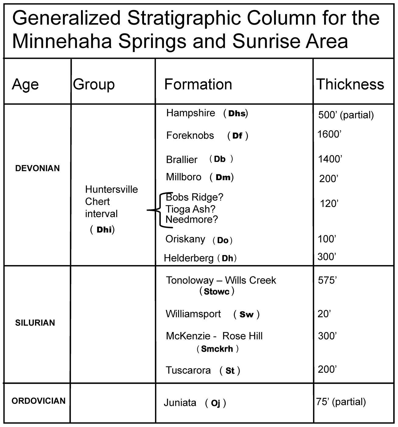
Rock units in the Minnehaha Springs/Sunrise area range in age from Ordovician through Devonian. Shown above is a chart of the stratigraphic units encountered in the mapping area.
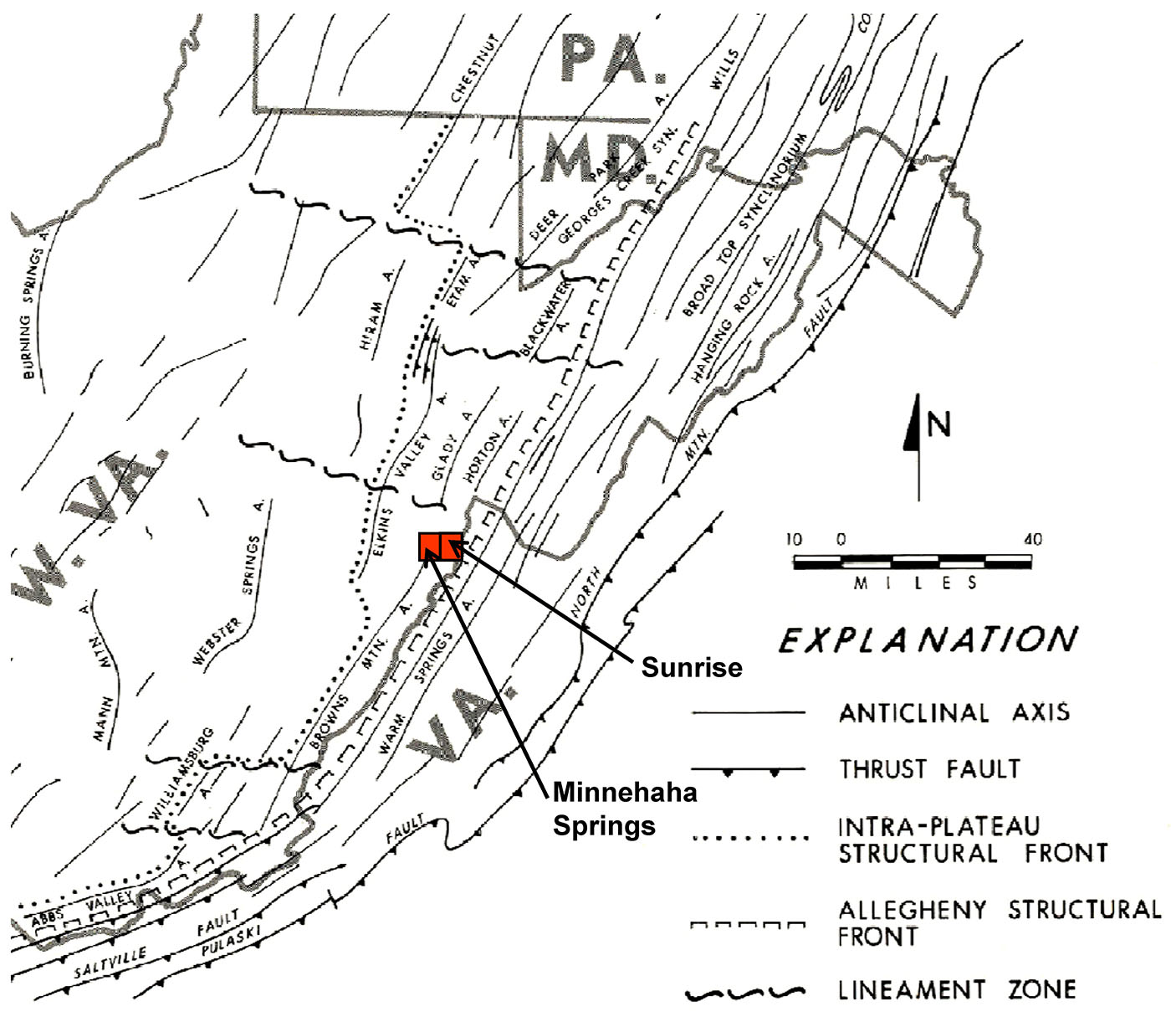
The Minnehaha Springs and Sunrise quadrangles lie between the Allegheny Front to the east and the Appalachian Plateau to the west (see map above from Kulander and Dean, 1978). As a result, the quadrangles exhibit a mixture of very complex and only moderate deformation. Deformation takes the form of folding and faulting and is most notable in the western portion of the Minnehaha Springs Quadrangle. Strikes, fold axes, and fault traces generally trend northeast-southwest. Intense folding in the western portion of the study area associated with the Brown's Mountain Anticline was probably initiated by thrust faulting deeply "rooted" in Silurian or Ordovician shales present in the subsurface. Deformation propagates readily through overlying units resulting in west-vergent compressional folding of strata in the area. The Silurian Tuscarora Sandstone is the dominant ridge former. As observed on quadrangles farther to the north, where exposed, the Silurian Williamsport Sandstone forms an excellent marker bed when interpreting the complex structure in the map area.
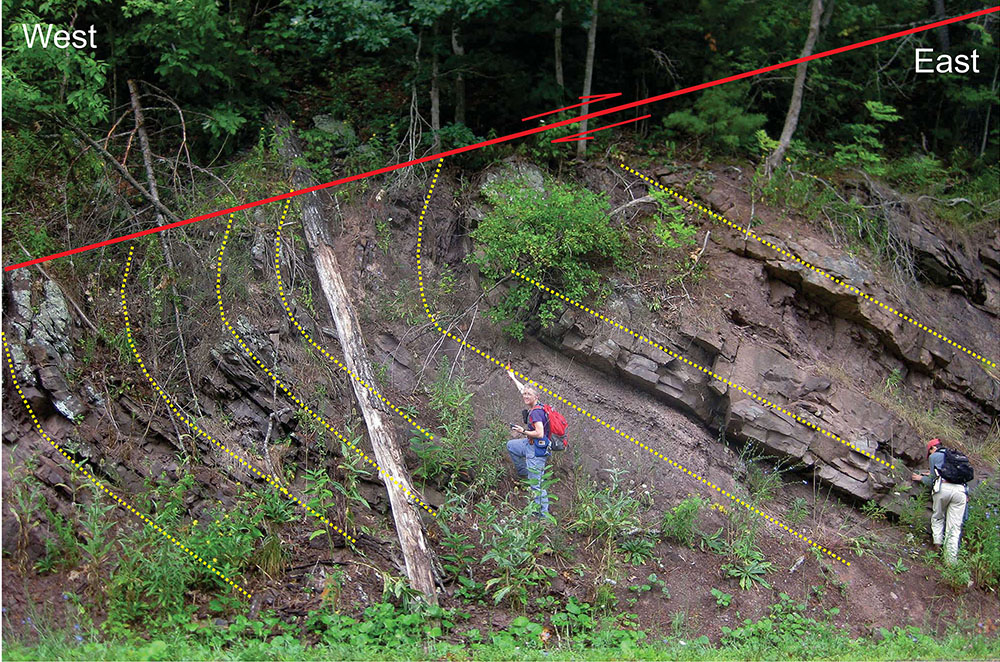
Below, WVGES Geologists Paula Hunt and Jaana Hitzig point out a thrust fault in the Ordovician Juniata Formation exposed along WV 39/92, northwest of Minnehaha Springs, WV.
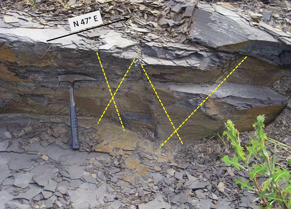
Above, intersecting joint sets (yellow lines) in the Devonian Millboro Shale along WV 92, north of Minnehaha Springs, WV.
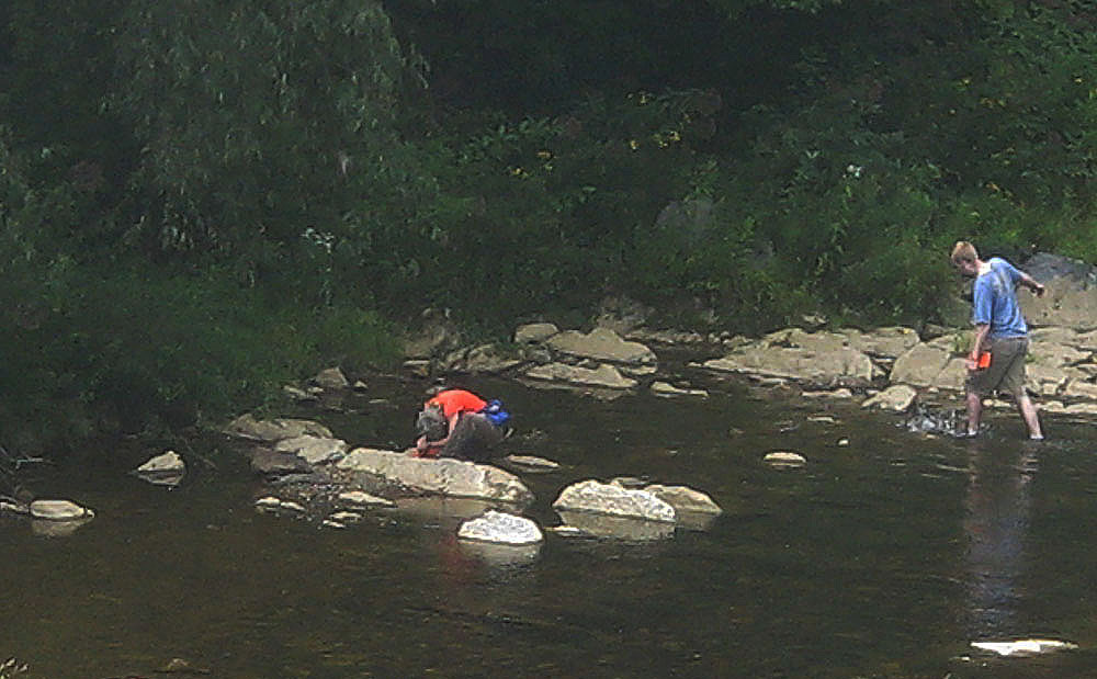
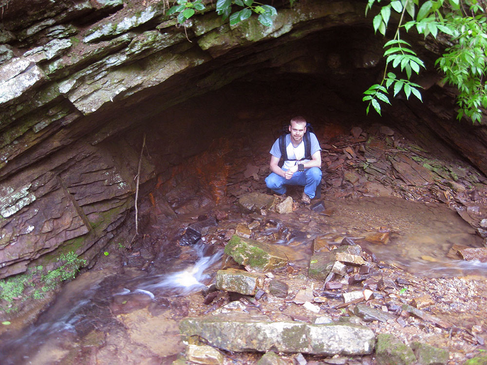
Heavy vegetation and soil cover hamper the delineation of contacts except where the most resistant units are present; in addition, extremely limited road and trail access forced the authors to rely heavily on aerial photography, SLAR imagery, the Dissertation map of Kulander (1968), and an unpublished field camp project map from West Virginia University (Kammer, 2012, personal communication) for the interpretation of structure and stratigraphic contacts. A number of the map units were so poorly exposed that their characterization had to be taken from the adjacent Cloverlick and Paddy Knob quadrangles to the north. In past years, the Devonian Needmore and Millboro shales have been observed as distinct mapping units, generally separated by the thin Tioga Ash. Investigation of the Cloverlick Quadrangle in 2011-2012 demonstrated the situation was complicated by the presence of multiple Tioga ashfall layers observed to be interbedded with both the Needmore and a glauconitic sandstone, the Bobs Ridge. Further complicating the situation, much of the Needmore, Tioga, and Bobs Ridge were heavily silicified and as a result, the Needmore and Millboro could not be consistently differentiated. Instead, the Millboro was mapped as a distinct unit and the silicified material was mapped as the Huntersville Chert "interval." On the Minnehaha Springs Quadrangle, the presence of this unit can only be inferred based on the location of two chert quarries thought to be within this interval. The Silurian McKenzie and Rose Hill formations, which are distinctive, mappable units farther to the north because of the presence of the intervening Keefer ironstone and prominent ferruginous sandstones in the Rose Hill, were greatly reduced in thickness. We believe this thinning is related to changing of sedimentary facies which resulted in the loss of resistant sandstones in the Rose Hill and the absence of the Keefer - the two units were not differentiated within the map area. In addition, the Silurian Tonoloway and Wills Creek formation were similarly so poorly exposed that they were mapped as an undifferentiated unit. Below, WVGES Geologists Paula Hunt and George Case investigating steeply dipping Silurian carbonates in Knapp Creek at Minnehaha Springs, WV.
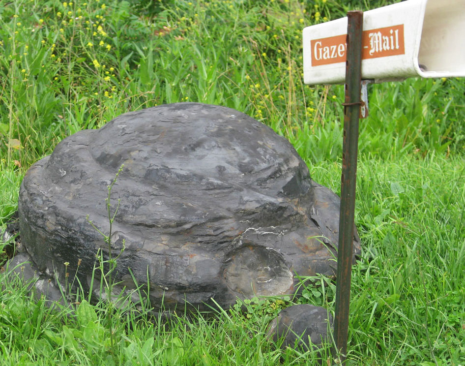
Below, large carbonate nodule from the Devonian Millboro Shale used as a lawn ornament along WV 92, north of Minnehaha Springs, WV.
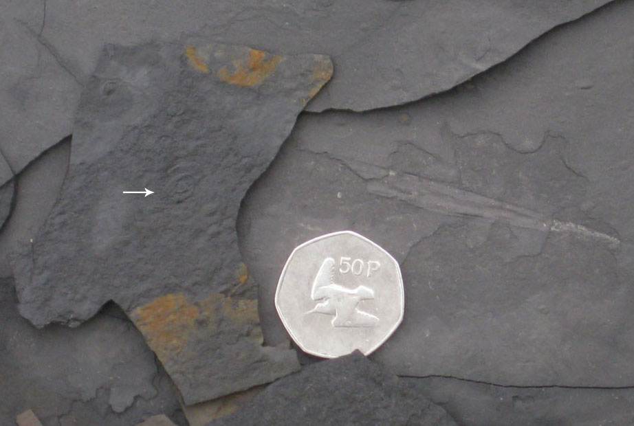
Above, typical depauperate (adults exhibiting stunted growth) fauna of the Devonian Millboro Shale. Miniature adult cephalopod (arrow) and a flattened Styliolina sp. (cone-shaped phosphatic shell) are visible. Coin is 3 cm. in diameter.
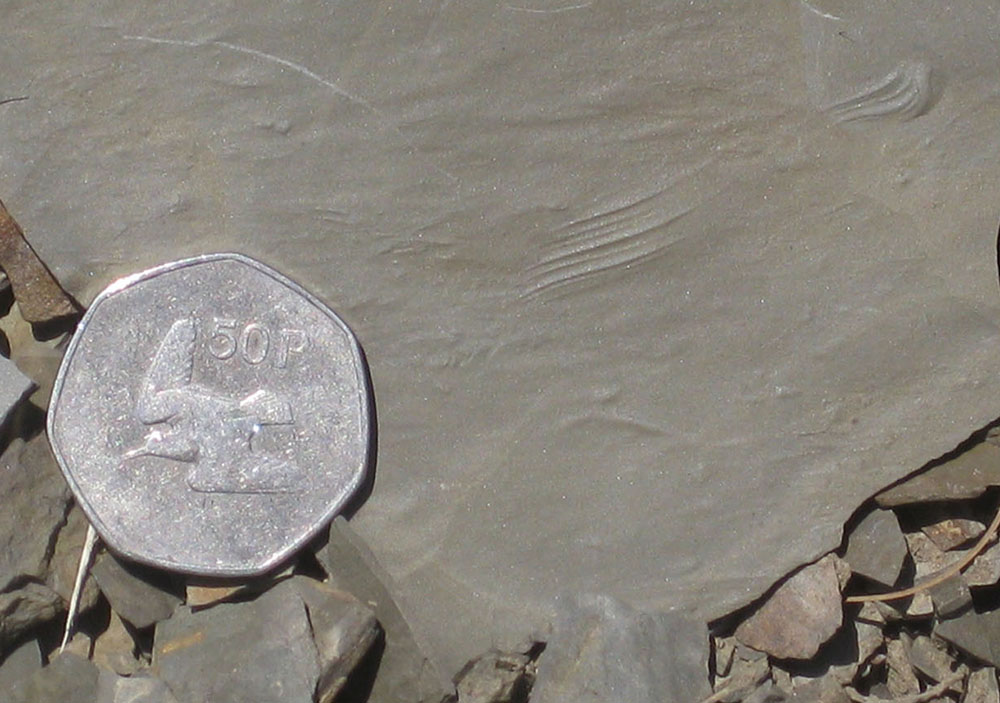
Below, an example of the trace fossil (Monomorphichnus sp.) in the Devonian Brallier Formation along WV 92, southwest of Frost, WV. This fossil was made an arthropod (probably a trilobite) caught in an unexpected current and dragging its feet in the bottom sediment. Coin is 3 cm in diameter.
Above, WVGES Geologist George Case inside a small asymmetrical anticline in the Silurian Rose Hill Formation along Rainbow Run, southwest of Frost, WV.
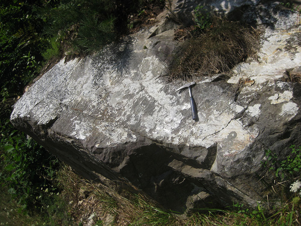
Below, slickensides on a fault surface in the Silurian Tuscarora Sandstone. White mineral coating the surface is silica (SiO2) produced from granulation and pressure dissolution of quartz sand grains adjacent to the surface. Exposure along WV 92, northwest of Minnehaha Springs, WV.
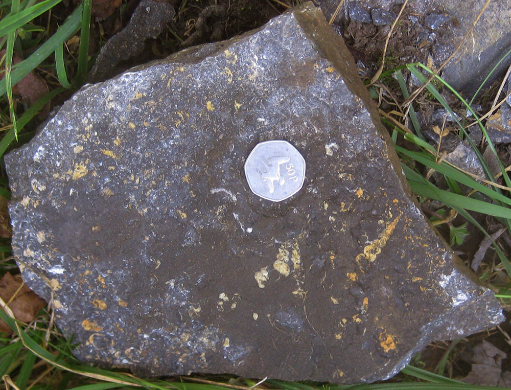
Above, high-spired fossil gastropods (Hormotoma sp.) in a sample of carbonate from the Wills Creek Formation. Exposed along Sunset Road South near the intersection with WV 92, northwest of Minnehaha Springs, WV. These snails are believed to have lived by grazing on marine algae. Coin is 3 cm in diameter.
A total of 26 bedrock samples were collected for geochemical analysis during the field season. Analytical results have been combined with data from past year's STATEMAP projects in a geochemical database available to the general public as West Virginia Geological Survey Report of Investigations RI-34 (McDowell, 2001). Concurrent with this year's STATEMAP project, the geochemical database has been brought up to date with the inclusion of new results. A GIS-based version which uses this database is available.
![]()
![]()
Page last revised June 2013
Page created and maintained by:
            West Virginia Geological & Economic Survey
  Address:  Mont Chateau Research Center
            1 Mont Chateau Road
            Morgantown, WV  26508
Telephone:  1-800-WV-GEOLOgy (1-800-984-3656) or 304-594-2331
      FAX:  304-594-2575
    Hours:  8:00 a.m. - 5:00 p.m. EST, Monday - Friday
Permission to reproduce this material is granted if acknowledgment is given
to the West Virginia Geological and Economic Survey.