Contact Us    |   WVGES Home
WVGES logo

Ask Us!

Frequently Asked Questions

Dividing Line

How much of West Virginia was covered by glaciers during the "Ice Age?"

While no part of the State was covered by glacial ice during the stages of glacial advance in the Wisconsinan stage, the climate in West Virginia, however, was several degrees colder than it is today. Peri-glacial (in front of the glacier) effects can be seen in Cranesville Swamp in Preston County and Cranberry Glades in Pocahontas County, which have been bogs or lakes at least since the coldest period of the last glacial epoch, and in patterned-ground features (i.e., the effects of ground frost) at Dolly Sods and the Canaan Mountain/Valley area in Tucker County and Spruce Knob in Pendleton County.

glacier map
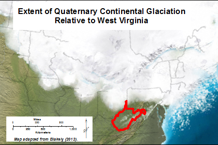
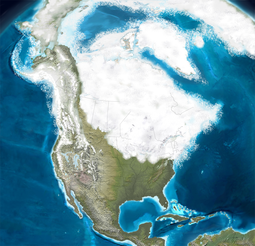
Quaternary Glaciation in the northeastern U.S. (adapted from Blakey, 2012)

Some stream drainage patterns existing in the state prior to the "Ice Age" were altered by the presence of glaciers to the north. The preglacial Teays River system (which included what is now the New, Gauley, and Kanawha rivers) was the major drainage outlet in the southern part of the state during the early Pleistocene and before. The Teays was dammed by ice near Chillicothe, Ohio forming Lake Tight, sometimes called Lake Teays. Stream capture of the Teays, likely from the Kanawha River, left an abandoned river valley still visible today between the Charleston area near Nitro and Huntington, now occupied by Interstate 64.

Teays map
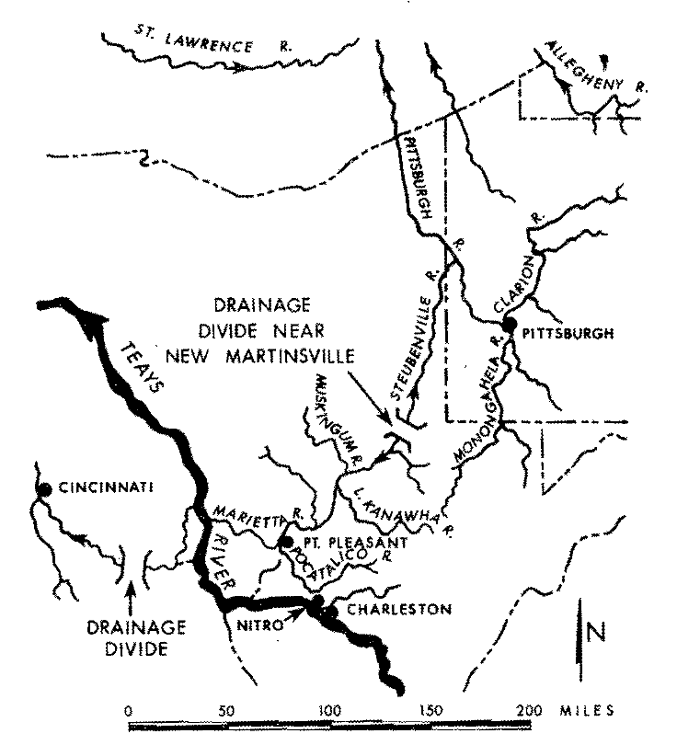
Pre-Pleistocene drainage in West Virginia and surrounding area (Welker, 1982; adapted from Fridley, 1950)

The path of the Ohio River as we now know it reflects a substantial change. Along the border of the northern panhandle, north from Moundsville, there is evidence that an ancestral river flowed north. There is widespread belief among geologists that the glaciations of North America during the past two million years were responsible in part for creating the Ohio River drainage system that exists today. A major abandoned channel is today downtown Weirton. The development of the steel industry took advantage of this abandoned channel above flood level as "flat land" on which to build the steel mills.

In the northern part of the State, ancient "Glacial" Lake Monongahela was formed by outwash, or possibly ice, damming the north-flowing Monongahela River and its tributaries just above the tip of the northern panhandle. This lake covered all land below 1,100 feet in elevation in parts of northern West Virginia as far south as Weston, and in southwestern Pennsylvania. We can attribute the sandy and silty soils from Fairmont upstream and the varved clays in the Morgantown area to the presence of this lake.

For more information:


Page last revised January 7. 2020.
Please send web site questions, comments, or suggestions to webmaster.
WVGES address   WV Geological & Economic Survey
1 Mont Chateau Road
Morgantown, WV 26508
Phone: (304) 594-2331
Fax: (304) 594-2575
info@wvgs.wvnet.edu
fb icon

Valid XHTML 1.0 Transitional
WVGES Welcome Page
Welcome Page